Posted by
NASA Space Information,Shuttle Station,Moon Mars,Solar System, Earth,Universe, Aerona

PROPOSED The following is an alphabetical list of Earth science satellites and instruments developed and managed by the Jet Propulsion Laboratory. For a complete list of all NASA Earth-science missions, visit NASA Science: Earth.
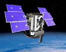
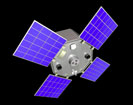 ACRIMSAT ACRIMSAT
Launched in 1999, AcrimSat studies the sun's energy output with uniform sensitivity from the far-ultraviolet to the far-infrared wavelength range. Its data are used to improve knowledge of the sun's role in global change.
More information | | |
 |
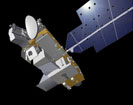
 AIRS AIRS
This instrument flies aboard NASA's Aqua satellite to make highly accurate measurements of air temperature, humidity, clouds and surface temperatures
Mission home page | | |
|
 AQUARIUS AQUARIUS
Planned for launch in 2010, the Aquarius instrument will provide the first-ever global maps of salt concentration in the ocean surface needed to understand heat transport and storage in the ocean. The project is being developed by NASA and the Space Agency of Argentina.
Mission home page | | |
|
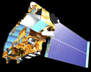 ASTER ASTER
The Advanced Spaceborne Thermal Emission and Reflection Radiometer is an imaging instrument flying on NASA's Terra satellite. It is designed to obtain high-resolution global, regional and local images of Earth in 14 color bands.
Mission home page | | |
|
 CLOUDSAT CLOUDSAT
Launched in April 2006, CloudSat monitors the state of the Earth’s atmosphere and weather with a sophisticated radar system. The instrument, jointly developed with the Canadian Space Agency, can predict which clouds produce rain, observe snowfall, and monitor the moisture content of clouds.
Mission home page | | |
|
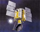
 GRACE GRACE
The twin Gravity Recovery and Climate Experiment (GRACE) spacecraft observe and measure the gravitational field of the Earth. The findings from this mission shed light on the shape and composition of the planet and the distributions of water and ice. The mission was launched in March 2002.
Mission home page | | |
|
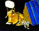
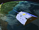
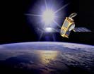
 JASON 1 JASON 1
Launched in December 2001, the Jason-1 spacecraft uses microwaves to monitor the height of the water of the Earth’s oceans. This information helps scientists understand weather patterns like El Niño, predict the formation of hurricanes, and observe the mean height of the oceans as they rise due to climate change.
Mission home page | | |
|
 MISR MISR
Launched aboard NASA's Terra satellite, the Multi-angle Imaging Spectro-Radiometer (MISR) instrument is a sophisticated imaging system that collects images from nine widely spaced angles as its satellite glides above Earth.
Mission home page | | |
|
 MLS MLS
This instrument, which flies aboard NASA's Aura spacecraft, is designed to improve our understanding of ozone, especially how it is depleted by processes of chlorine chemistry.
Mission home page | | |
|
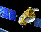
 OSTM (JASON-2) OSTM (JASON-2)
Scheduled for launch in 2008, the Ocean Surface Topography Mission (OSTM) is a follow-on to the Jason-1 mission. It will monitor the height of the water of the Earth’s oceans to help scientists understand weather patterns like El Niño, predict the formation of hurricanes, and observe the mean height of the oceans as they rise due to climate change.
Mission home page | | |
|
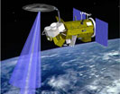
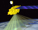
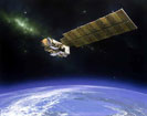
 QUIKSCAT QUIKSCAT
QuikSCAT is primarily known as a powerful weather-monitoring tool that bounces bursts of microwaves off of the Earth’s surface to measure wind speeds. This information is important to scientists who study the impact climate change has on weather patterns and severity. QuikSCAT was launched in June 1997.
More information | | |
|
| |


0 comments:
Post a Comment